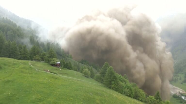
Four distinct AR events are forecast to impact the Pacific Northwest and Northern California between December 23 and December 28, bringing heavy rainfall and significant moisture transport.
The NWS Weather Prediction Center anticipates 7 – 15 inches (180 – 380 mm) of total precipitation in parts of western Washington, western Oregon, and Northern California over the next seven days.
Numerous stream gages are expected to rise above action or bankfull stages, with the highest flooding potential in southwestern Oregon.
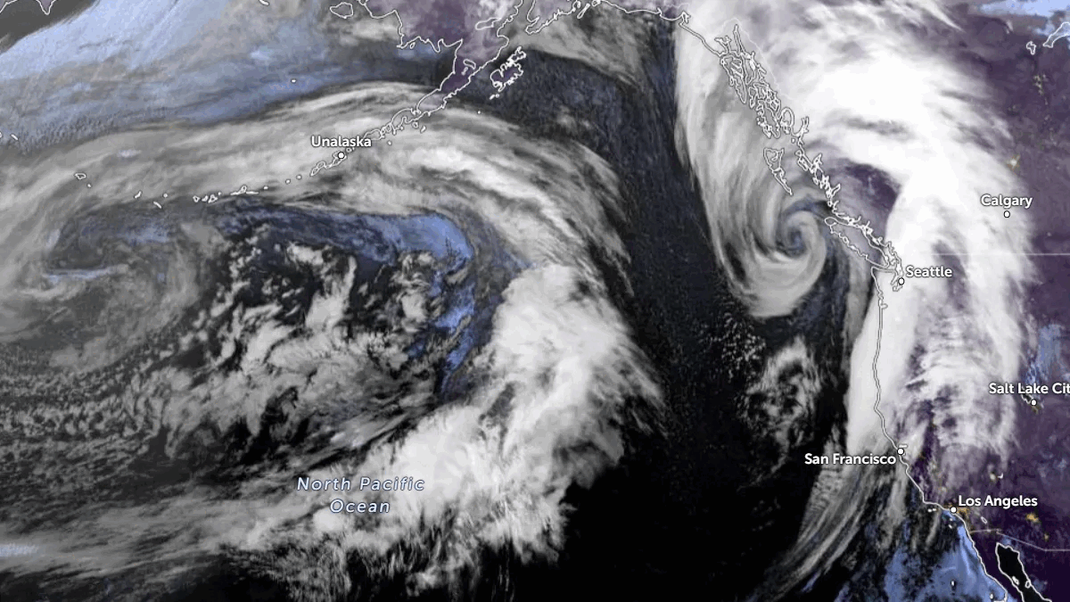
A series of atmospheric rivers (ARs) are expected to continue propagating across the North Pacific, impacting the Pacific Northwest and Northern California over the next seven days.
The first AR made landfall on Monday, with AR 2/AR 3 conditions (IVT > 500 kg m⁻¹ s⁻¹) forecast in coastal Southern Oregon. South-southwesterly IVT is expected to enhance orographic precipitation over portions of the Northern California Coast Ranges, Southern Cascades, and Northern Sierra Nevada as the AR passes over Northern California.
The second AR is predicted to make landfall on Wednesday, December 25, bringing moderate AR conditions to coastal Washington, Oregon, and Northern California.
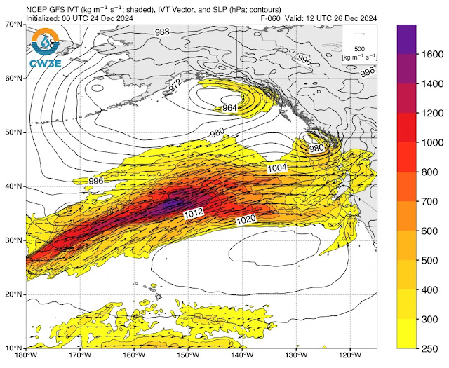
The third AR is expected to make landfall on Thursday, December 26, with the strongest moisture transfer anticipated over Northern California.

AR conditions (IVT > 250 kg m⁻¹ s⁻¹) are also forecast for Central and Southern California during the third AR; however, the northwesterly IVT direction is not expected to be favorable for significant precipitation in these areas.
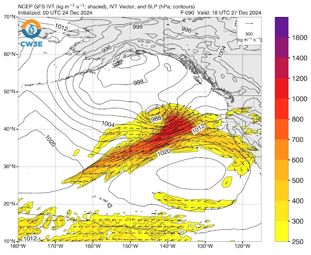
The fourth AR is forecast to make landfall on Friday, December 27, potentially bringing AR conditions (IVT > 750 kg m⁻¹ s⁻¹) to coastal Oregon. A mesoscale frontal wave (MFW) is expected to develop near the tail of the AR after it moves onshore. This MFW could lead to a cyclogenesis event and a second, stronger pulse of moisture transport over the Pacific Northwest. However, there is considerable uncertainty in the evolution of this AR.

The NWS Weather Prediction Center forecasts 7 – 15 inches (180 – 380 mm) of total precipitation over portions of western Washington, western Oregon, and Northern California over the next seven days.
Differences in model predictions for the evolution of these ARs are resulting in varying precipitation forecasts. The EPS model predicts significantly higher precipitation totals across western Oregon and Northern California over the next ten days compared to the GEFS model.
A marginal risk excessive rainfall outlook (ERO) has been issued for the Southern Oregon and Northern California Coast Ranges, as well as the Northern Sierra Nevada foothills, for today through early Wednesday.
Marginal risk EROs have also been issued for coastal Washington, Oregon, and Northern California from Wednesday through early Saturday, December 28.
Numerous stream gages in western Washington, western Oregon, and Northern California are forecast to rise above the action or bankfull stage over the next ten days, with the greatest potential for flooding in southwestern Oregon.
From: watchers.news