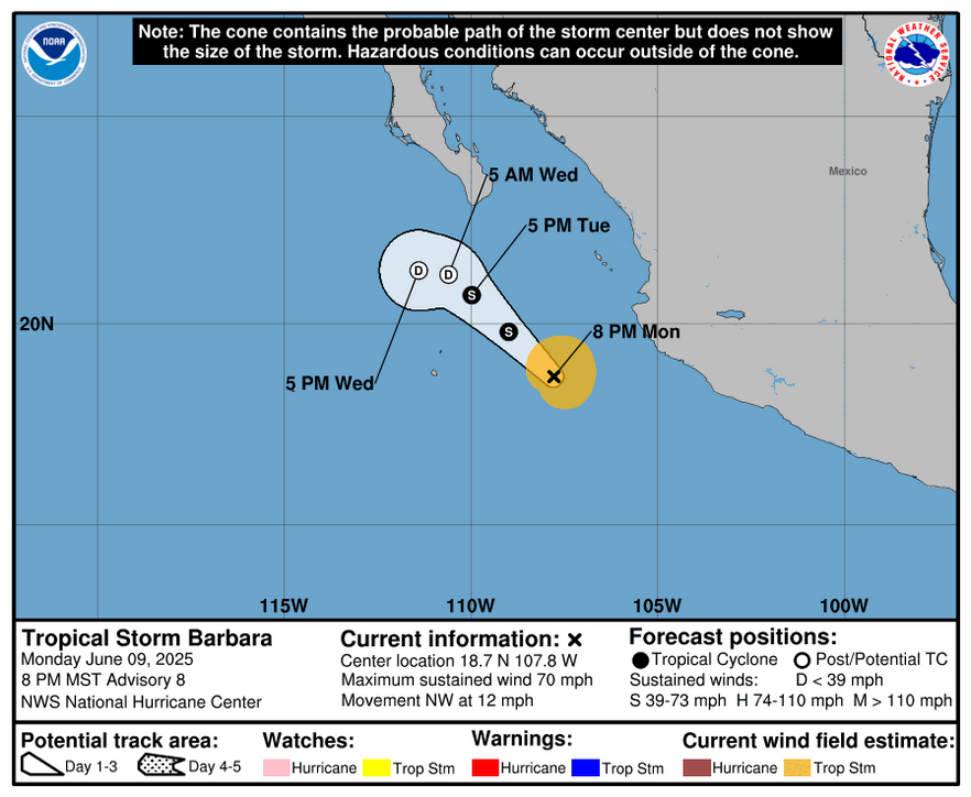
As of 03:00 UTC on June 10, Tropical Storm Barbara had maximum sustained winds of 110 km/h (70 mph) and was located roughly 370 km (230 miles) west of Manzanillo, Mexico.
The system had an estimated minimum central pressure of around 993 hPa and was moving northwestward at 19 km/h (12 mph). It is forecast to continue moving in the same direction through June 11, followed by a westward turn. Tropical-storm-force winds extend outward up to 129 km (80 miles) from the center.
Image credit: NHC
Barbara is expected to be a remnant low by late tonight into June 11, just south of Los Cabos.
In addition to very rough seas near the center of the storm, swells generated by Barbara will affect portions of the coast of southwestern Mexico during the next day or so. These swells are likely to cause life- threatening surf and rip current conditions.
The center of Tropical Storm Cosme, west of Barbara, is currently located about 975 km (605 miles) SSW of the southern tip of Baja California. At 09:00 UTC today, the system had maximum sustained winds of 110 km/h (70 mph), minimum central pressure of 993 hPa and was moving WNW at 7 km/h (5 mph).
Scattered moderate convection is ongoing within 170 km (105 miles) to the northwest and 110 km (70 miles) to the southeast of the center. Rough to very rough seas are noted within 170 km (105 miles) in the northeast semicircle and 85 km (50 miles) in the southwest semicircle of the storm.
Cosme will weaken over the next couple of days as it moves into an area of cooler water, and is forecast to become a remnant low pressure system on June 11 between Socorro and Clarion Islands.
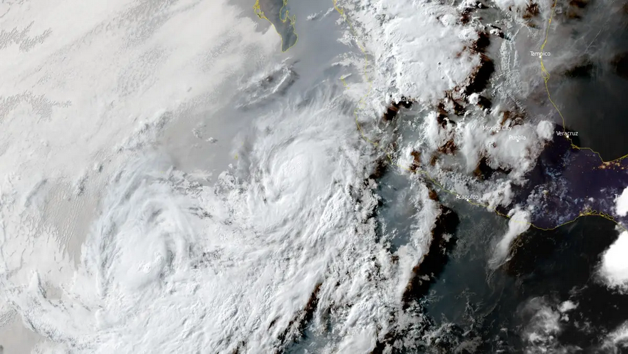
Tropical storm cosme (left) and hurricane barbara (right) at 0030 utc on june 10 2025Tropical Storm Cosme (left) and Hurricane Barbara (right) at 00:30 UTC on June 10, 2025. Credit: NOAA/GOES-East, RAMMB/CIRA, The Watchers
Looking ahead, an area of low pressure is forecast to develop later this week south of southern Mexico.
Environmental conditions appear conducive for some gradual development of this system, and a tropical depression could form late this week or over the weekend, NHC forecaster Christensen noted. There is a high chance of tropical cyclone formation over the next 7 days.
From: watchers.news


